 TOWN OF BRIDGEWATER SERVICE NOTICES >>> Service notices will be placed in this section as they are received
BRIDGEWATER TRANSIT >>> There will be no Bridgewater Transit service on Saturday, January 29, 2022.
WASTE SITE UPDATE >>> The Lunenburg Regional Community Recycling Centre will be closed Saturday, January 29, 2022, due to the storm. The site will reopen at 8 am Monday. Questions? Call (902) 543-2991 or visit www.communityrecycling.ca.
LCLC UPDATE >>> Closed for January 29, 2022.
SOUTH SHORE PUBLIC LIBRARIES UPDATE >>> Cosed for January 29, 2022.
DESBRISAY MUSEUM >>> Closed for January 29, 2022.
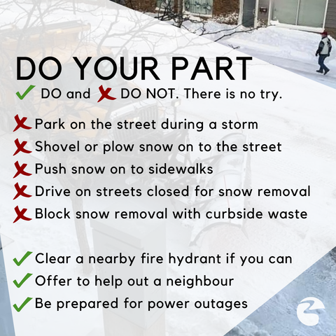
WINTER PARKING ALERT >>> During and after a storm, under Section 139 of the Motor Vehicle Act there is no parking permitted on streets. Parking a vehicle on the street will obstruct necessary winter maintenance and is a safety hazard. If you leave your vehicle parked on the street during a storm, it could be ticketed and towed at your expense -- please ensure you find off-street parking for your vehicle during and after a storm as clean-up operations take place.
CLOSED STREETS >>> If you encounter a street that has been barricaded/closed to traffic so that snow removal can take place, do NOT drive past the barricade and use that street. Travelling on streets that have been closed for snow removal is hazardous to both you and snow-clearing operators, and you may not be able to exit the work area at the other end. Please abide by street closures for snow removal and change your travel route accordingly.
WINTER STORM WARNING IN EFFECT FOR LUNENBURG COUNTY >>> Per Environment Canada: Hazardous winter conditions are expected. A winter storm will bring snow, blowing snow, freezing rain and strong winds. Total snowfall: 15 to 40 cm. Freezing rain duration: 3 to 6 hours. Maximum wind gusts: 80 to 100 km/h.
Locations: Most of mainland Nova Scotia and portions of western Cape Breton. Time span: Friday night through Sunday morning.
Remarks: Snow at times heavy and blowing snow will begin late tonight in southwestern regions and will quickly spread northeastward Saturday morning. Snow is expected to transition to an extended period of freezing rain or ice pellets throughout the day on Saturday, before changing to rain later in the day in most regions. The highest snowfall totals are expected over western regions, where precipitation is unlikely to transition to rain. Freezing rain will be most significant inland away from the immediate Atlantic coast.
Strong wind gusts will likely cause power outages Saturday and again late overnight Saturday into Sunday morning, Strongest wind gusts are expected over exposed coastal locations.
Temperatures will fall well below zero Sunday morning behind the storm, causing standing water to freeze. Rapidly accumulating snow could make travel difficult over some locations. Ice build-up may cause tree branches to break. Winter storm warnings are issued when multiple types of severe winter weather are expected to occur together.
Please continue to monitor alerts and forecasts issued by Environment Canada. To report severe weather, send an email to
SNOW-CLEARING REMINDERS >>> Do not move or plow snow from your property on to a street or sidewalk. Not only is that not helpful to drivers and pedestrians alike, it's actually a violation of Section 318 of the Municipal Government Act. Under the rules in that section, no person shall deposit snow or ice on the travelled way of a street or near a portion of the travelled way that hinders clearing efforts. That regulation extends to citizens and private contractors who have been hired to conduct snow-related property maintenance.
If you're putting out your compost cart or waste bags for pick up, please ensure that those items are not placed on the sidewalk or in a manner that could impede snow clearing or pedestrian traffic.
SNOW CLEARING ORDER OF OPERATIONS >>>
-- There are about 70 kms of streets and 35 kms of sidewalks in Bridgewater, so cleaning up after a storm takes time. Be patient and, if possible, please stay off the roads until snow clearing has taken place. This makes it easier for plow operators and lessens the potential burden on emergency responders.
-- Roads are generally salted before a storm to deter the formation of a layer of ice on asphalt below snow cover.
-- Plowing typically begins when there is about 7 to 10 cm of snow down, with priority being given to primary routes within the first 12 hours after a storm. Supervisors are in communication with emergency officials during a storm to coordinate response to emergency calls as needed.
-- From 12 to 24 hours after a storm, focus areas generally include school zones, the downtown, secondary streets, then sidewalk maintenance.
-- Plow It Forward: if you can help out a neighbour or volunteer to clear a fire hydrant, it helps your community!
-- PLEASE NOTE: THESE SERVICE LEVELS ARE BASED ON A TYPICAL WINTER SNOWFALL OF ABOUT 20CM. FOR LARGER WINTER STORMS, OR STORMS WHERE FREEZING RAIN/ICE ARE MIXED IN, ADDITIONAL POST-STORM CLEAN UP TIME WILL BE REQUIRED. PLEASE BE PATIENT, SAFE, AND ONLY MAKE ESSENTIAL TRIPS OUT WHILE STORM-CLEARING OPERATIONS ARE TAKING PLACE.